• No Recent Update
  • Current Weather
  • Beginner
  • 25+ miles
  • Stacked Loops
  • Gravel Routes

Many people generally ride Busch in a counter-clockwise (CCW) direction working the hiking/biking trail into the loop. Some of the gravel roads are just out and backs so you just have to explore. It’s a good place to ride when singletrack trails are too wet.

The Missouri Department of Conservation (MDC) is currently working with Great Rivers Greenway to get a trail in place that will connect Research Park to the Hamburg Trail, which will make a great wet weather route by creating a big loop using the Hamburg, KATY and Research Park trails.

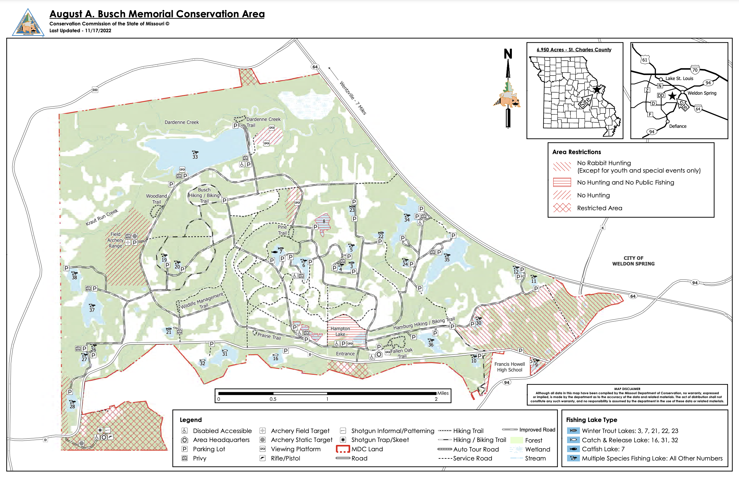
Below is a map that shows the Busch roads open to bikes (the service roads are now open to bikes) and the Busch Hiking/Biking Trail. The map also shows the lake numbers, which is helpful when trying to navigate the maze of roads out here. There are many options to connect loops and create your own route. With 25+ miles of gravel roads and the 3.2 mile trail you can really create a large and lengthy loop.

The area is open until 10 pm, so it’s a good place to ride at night.

ABOUT BUSCH MEMORIAL CONSERVATION AREA

(Reprinted from MDCOnline)
The 3,035 acre August A. Busch Memorial Conservation Area was purchased by the Missouri Department of Conservation in 1947 from the federal government. Mrs. August A. Busch, Sr. donated a portion ($70,000) of the cost toward the purchase of the area as a memorial to her late husband.

In the early 1940’s, the area was used by the Department of Army as a TNT munitions plant to support the World War II effort. There are still 100 of the old TNT storage bunkers that exist on the area.

Portions of the August A. Busch Memorial Conservation Area were used by the Department of Army in the 1940’s for TNT and DNT production and by the Atomic Energy Commission in the 1960’s for uranium ore processing. The affected portions were all part of a federal environmental cleanup project and required to meet certain environmental health and safety standards. The area is now considered to be safe for all recreational pursuits allowed on the area, as well as the wildlife found within the area.

Latest trail conditions

Our site utilizes crowd-sourced data to provide the latest conditions and that includes you. Be sure you are logged in first or set up a free account before updating a trail condition.

Update trail condition

No Trail Conditions